Overview of Mesa Arch
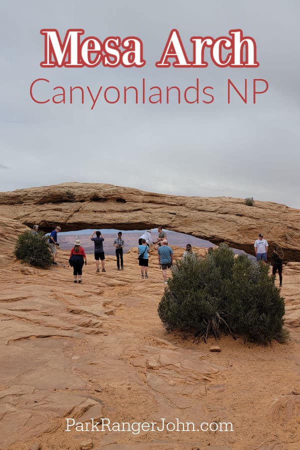
Mesa Arch is a breathtaking stone arch that sits on the edge of a cliff, offering stunning views of the La Sal Mountains, rock spires, and Canyonlands National Park. While many consider this an easy hike, it’s important to be fully prepared for the journey to this incredible viewpoint. The trail leads hikers through a unique landscape that changes with the weather and the position of the sun throughout the day.
The arch itself is a popular spot for photography, especially during sunset when the light creates dramatic shadows and highlights. However, the view is equally beautiful at any time of day. Visitors can often see other geological features like Washer Woman Arch and Buck Canyon in the distance, which are accessible only via the 4-wheel drive White Rim Road.
Trail Details
The Mesa Arch Trail is a short, half-mile loop that starts from the parking lot. Despite being labeled as an easy hike, the trail includes rugged terrain with slick rock, sand, and uneven surfaces. Hikers should wear sturdy shoes and be prepared for a challenging walk, especially if they are not used to hiking at high elevations or on difficult terrain.
The trail begins with an uphill walk on dirt and stairs, followed by a section of sandstone rock and sand. There are natural sandstone steps that are uneven, making hiking poles useful for those with mobility issues. The path is not flat, requiring hikers to navigate through various types of terrain to maintain stability.
Once hikers reach the top, they will be greeted with panoramic views of the arch and the surrounding landscape. It’s a great spot to take a moment and appreciate the beauty of the area. However, visitors should be cautious near the edge, as there is a sheer drop just a few inches away from where people sit for photos.
Tips for Visiting
If you plan to visit Mesa Arch at sunrise, be prepared for large crowds. The park ranger at the contact station suggests arriving early to secure a good spot. Hiking the trail the day before can help familiarize yourself with the route and reduce stress on the morning of your visit.
For photographers, bringing a headlamp, hiking poles, a tripod, and a star filter can enhance the experience. Also, checking social media platforms like Pinterest and Instagram for sunrise photo ideas can help plan your trip more effectively.
Important Information
- Accessibility: The trail is not wheelchair accessible due to its uneven terrain.
- Parking: The parking lot can fill up quickly, so arriving early is recommended, especially for sunset or sunrise.
- Pets: Pets are not allowed on the trail.
- Facilities: Bathrooms are available at the trailhead and at the visitor center located 6 miles away.
Location and Directions
Mesa Arch is located 6.3 miles south of the Island in the Sky Visitor Center. Turn left (east) into the Mesa Arch Parking Area. The coordinates are 38.389174, -109.868150.
Additional Travel Resources
For those planning a longer stay, the Islands in the Sky Campground is the only campground near Mesa Arch. If you're exploring the Southwest, consider visiting other nearby attractions such as Arches National Park, Dead Horse Point State Park, Green River State Park, Goblin Valley State Park, and other national parks across Utah, Colorado, Idaho, Wyoming, Nevada, Arizona, and New Mexico.


